
(The Mog Nation Wiki, an archive)
4. Arakan Kingdom – 1431-1783
| # | Reign | King | relation |
|---|---|---|---|
| 1 | 1430-1433 | Narameik Hla -@ Mong Saw Mwan | Son of King Razathu |
| 2 | 1433-1459 | Naranu @ Mong Khari @ Ali Khan | Brother |
| 3 | 1459-1482 | Ba Saw Pru @ Kalima Shah | Son |
| 4 | 1482-1492 | Mong Dawlyar @ Maha Mawkhu Shah | Son |
| 5 | 1492-1494 | Ba Saw Nyo | Son of Mong Khari |
| 6 | 1494 | Mong Ran Aung | Son of Mong Dawlyar |
| 7 | 1494-1501 | Salingathu @ Theingathu | Uncle from mother’s side |
| 8 | 1501-1513 | Mong Raza @ Ali Shah | Son |
| 9 | 1513-1515 | Gazapati | Son |
| 10 | 1515 | Mong Saw Oo @ Thirithu | Brother of Salingathu |
| 11 | 1515-1521 | Thazata @ Ali Shah | Son of Mong Dawlyar |
| 12 | 1521-1531 | Mong Khaung Raza | Brother |
| 13 | 1531-1553 | Mong Ba Gree @ Mong Bong | Son of Mong Raza |
| 14 | 1553-1555 | Mong Taikkha @ Mong Diyar | Son |
| 15 | 1555-1564 | Mong Saw Hla | Son |
| 16 | 1564-1571 | Mong Sekkya @ Sekkyawadai | Brother |
| 17 | 1571-1593 | Mong Phaloung | Son of Mong Ba Gree |
| 18 | 1593-1612 | Mong Raza Gree @ Thadoe Damma Raza | Son |
| 19 | 1612-1622 | Mong Khamong @ Wara Damma Raza | Son |
| 20 | 1622-1638 | Thirithudamma Raza @ Mong Hari | Son |
| 21 | 1638 | Mong Sanai @ Thadoe Mong Hla | Son |
| 22 | 1638-1645 | Narapatigri @ Nga Kuthala | Son |
| 23 | 1645-1652 | Thaddoe Mong Tara | Son |
| 24 | 1652-1674 | Sandathudamma Raza | Son |
| 25 | 1674-1685 | Oaggabala Raza @ Thirithuriya | Son |
| 26 | 1685-1692 | Waradamma Raza | Younger brother |
| 27 | 1692-1694 | Manithudamma Raza | Elder brother |
| 28 | 1694-1696 | Sandathudamma Raza | Younger brother |
| 29 | 1696 | Ngaton Naw Rahta | Son |
| 30 | 1696-1697 | Maronpiya | Outsider |
| 31 | 1697-1698 | Kalamandat | Outsider |
| 32 | 1698-1700 | Naradipadi | Son of Sandathudamma Raza |
| 33 | 1700-1706 | Sandawimala Raza | Grandson of Thadoe Mongtara |
| 34 | 1706-1710 | Sandathuriya Raza | Grandson of Sanda thudamma Raza |
| 35 | 1710-1731 | Sandawizaya Raza | Outsider |
| 36 | 1731-1734 | Sandathuriya | Son in law |
| 37 | 1734-1735 | Naradipati | Son |
| 38 | 1735-1736 | Narapawara | Younger brother |
| 39 | 1737 | Sandawizala | Younger brother |
| 40 | 1737-1742 | Madareit | Younger brother of Narapawara |
| 41 | 1742-1761 | Nara Abbaya | Uncle |
| 42 | 1761 | Thirithu | Son |
| 43 | 1761-1764 | Sandaparama Younger | brother |
| 44 | 1764-1773 | Ahbaya Maha Raza | Brother in law |
| 45 | 1773-1777 | Sandathumana | Brother in law |
| 46 | 1777 | Sandawimala | Outsider |
| 47 | 1777-1782 | Sandathadaiktha Damareik | Outsider |
| 48 | 1782-1784 | Mahathamada Aggaw Ponnyazaw Raza | Outsider |
Arakan formed a separate kingdom over which various dynasties are supposed to have ruled in an unbroken line of succession from 2666 BC down to 1784 AD, when Thamada, who ruled at the city of Myauku (or Myohaung), was conquered and taken prisoner by Bodaw Paya, king of Ava.
After 1430 the Arakanese regained their independence, and throughout the sixteenth century repelled the raids of the Burmans from the mountains and the Portuguese from the sea. Different names are applied to the same individuals among the later Arakanese kings. After the time of Meng Tsau-mwun when they became for a time tributary to Bengal, and later still when they ruled over the present Chittagong district, they assumed foreign names, and their Bengal subjects distinguished them by Indian names and titles, which are now frequently applied to them, though the same Indian names are not always applied to the same individual kings, even by the best informed among the Arakanese. Hence arises confusion.
During the latter half of the sixteenth century Arakan came in contact with the Mughal power, through the conquest of Chittagong, and the Arakanese called in the Portuguese to help them. Their dubious allies, however, proved to be nothing less than pirates, and had to be expelled from the lands given to them in 1605. On being thus ejected they settled in the island of Sandwlp at the mouth of the Ganges and, having obtained assistance from Goa, attacked Arakan, but were defeated and driven from the country, while the victorious Arakanese began to harry the lowlands of Bengal. The power of Arakan was now at its zenith, but was soon to fall. Aurangzeb, the son of the emperor Shah Jahan, who had driven his brother Shah Shuja with all his family from Bengal into the hands of the king of Arakan, determined to avenge the extirpation of his kinsfolk by that king; and his viceroy, with the aid of the Portuguese, utterly crushed the power of Arakan. Charney notes that “The unusual experience of Arakan in the seventeenth century was in large part due to both the blockades by autonomous Portuguese freebooters in the ?rst two decades of the seventeenth century and the peculiar nature of a new trading relationship from the1630s until the 1660s between the Arakanese and the Dutch, based on the Arakanese supply of slaves and rice to Dutch port-cities and plantations. The ebb and ?ow of Arakanese fortunes throughout the century were thus tied to the fortunes of the Dutch. Expanding Asian empires in Bengal and Burma also in?uenced the decline of the Arakanese maritime polity after the Dutch withdrew from Arakan in the 1660s. Afterwards, as the material resources of the Arakanese central court declined, the Arakanese littoral became politically fragmented, characterized and sustained by the rise of rival political centers and the rebellions of non-Arakanese ethnic groups who had been captured abroad and resettled in the Arakanese littoral.”
Arakan was further weakened by internal dissensions, and succumbed to the throne of Ava in 1784. It is probable that this conquest would have been only temporary had no other power been involved. Bu the ancient kingdom of Arakan, practically conterminous with the Division, ceased to exist in 1784. As it was, the refusal of the East India Company’s officials to surrender the Arakanese refugees who had been driven out of their country brought the conquerors into conflict with a mightier than Arakan. A series of minor aggressions culminated in the seizure by the Burmans of the island of Shahpuri, between Akyab and Bengal, and war was declared in 1824. After fighting near Myohaung, Arakan was cleared of Burmese troops and became a British possession by the Treaty of Yandabo in 1826. At its annexation in 1826, Rakhaing-pyi-gye, or the Arakan kingdom, was formed into a Province under the Bengal Government. It then extended as far south as Cape Negrais, and was divided into the four Districts of Akyab, An, Ramri (Ramree), and Sandoway. When Pegu was annexed, in 1852, the lower portion of Arakan between the Khwa and Cape Negrais was joined to Bassein District.
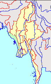
The Arakan Hill Tracts consist of parallel ridges of sandstone, covered with dense forest, and drained by numerous streams. The general run of these ranges is north and south; and wherever the rivers have been forced into an easterly or westerly course, the gaps in the barriers, which formerly dammed up the waters, may still be traced. The scenery at places is very wild and beautiful, but monotonous. The Kuladan (Koladyne), or Yam-pang, is the chief river. Its general course (which the wild tribes believed to run for some miles underground) is from north to south. During the dry weather it is navigable 120 miles above Akyab; the tide is felt as far as Kiindaw (Koondaw), 15 miles higher up. Beyond this point the river is a series of rapids and shallows, and its bed is rocky. Arakan comprised what formed the British division of Arakan, and as far as Cape Negrais. Pegu, or the Talaing Kingdom, seems in ancient times to have extended from a little below the city of Prome to the south coast as far as the Martaban Point. Burma comprehended the country north of Pegu, and eastward from Arakan, Cathay or Munipur, and Assam to the borders of China and Northern Siam. Its northern boundaries in early times would be difficult to define.
(This article first appeared on globalsecurity.org website at this link. – https://www.globalsecurity.org/military/world/myanmar/history-arakan-2.htm -)
the Series (of this article)
- 1. Danyawaddy Dynasties | The Mog Nation Wiki
- 2. Chandra Dynasty – AD 327-957 | The Mog Nation Wiki
- 3. Arakan Kingdom – 976-1404 | The Mog Nation Wiki
- 4. Arakan Kingdom – 1431-1783 | The Mog Nation Wiki
Source
- GlobalSecurity.org
End Notes and External Links
- Myanmar – Arakan Kingdom – 1431-1783
- Last updated on 9th February 2022
The Mog Nation Wiki
Kyaw Zaw Oo
- Kyaw Zaw Oo’s Blog
- Kyaw Zaw Oo | Facebook
- ကျော်ဇောဦး | Facebook
- Kyaw Zaw Oo | Twitter
